If you’ve been dreaming of snow-covered trails, peaceful mountain villages, and a sense of adventure that doesn’t overwhelm beginners, then the Kedarkantha trek is calling your name. This Himalayan gem offers a summit experience that’s doable even for first-timers. But to make the most of it, the first thing you’ll need is a clear and reliable Kedarkantha trek route map. At MND Travels, we’ve crafted this complete guide to help you understand the full route, prepare your itinerary, and know exactly what to expect on every step of the journey.
Kedarkantha Trek Route Map
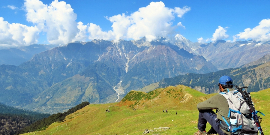
When planning a Himalayan adventure, knowing the exact trail is everything. The Kedarkantha trek route map gives you a detailed path from Sankri to the summit and back, covering all key points like Juda Ka Talab, Kedarkantha Base Camp, and Hargaon. With varying terrains, the route winds through forests, snowy slopes, and serene campsites — giving you a true sense of Uttarakhand’s beauty.
| Day | Activity | Altitude | Distance & Duration | Highlights |
|---|---|---|---|---|
| Day 1 | Drive from Dehradun to Sankri | 1,920 m / 6,400 ft | 220 km / ~10 hours | Scenic drive via NH123, valleys, forests, Govind National Park |
| Day 2 | Trek from Sankri to Juda-ka-Talab | 9,100 ft | 4 km / ~2.5 hours | Dense oak-maple forests, frozen lake views, wildlife sightings |
| Day 3 | Trek from Juda-ka-Talab to Kedarkantha Base (Lohasu) | 11,250 ft | 4 km / ~2.5 hours | Pine-oak forests, shepherd huts, snowy ridges, views of Bandarpoonch, etc. |
| Day 4 | Summit Kedarkantha Peak, then descend to Hargaon Camp | 12,500 ft (summit), 8,900 ft (Hargaon) | 6 km / ~7 hours | Sunrise at summit, 360° Himalayan views, Shiva-Parvati temple |
| Day 5 | Trek from Hargaon Camp to Sankri | 6,400 ft | 6 km / ~4 hours | Pine woodlands, paved trail, return to Sankri village |
| Day 6 | Drive from Sankri to Dehradun | Dehradun (~640 m / 2,100 ft) | 220 km / 8–10 hours | Beautiful mountain drive, arrival by 7–8 PM at Dehradun Railway Station |
Quick Itinerary for Kedarkantha Trek
If you’re short on time or simply want a clear snapshot of the trek, this section is for you. A quick itinerary helps you visualize how your days will be spent on the trail and what the Kedarkantha trek route map looks like in real time. Planning is half the adventure — and this schedule lets you do it with clarity.
- Day 1: Dehradun to Sankri – scenic drive through Mussoorie and pine valleys
- Day 2: Trek to Juda Ka Talab – through oak and pine forests
- Day 3: Ascend to Kedarkantha Base Camp – snowfields and open meadows
- Day 4: Summit trek – early morning climb with stunning views, descend to Hargaon
- Day 5: Trek to Sankri and return journey
This 5-day itinerary is one of the most balanced you’ll find on the Kedarkantha trek route map, giving you the perfect mix of challenge, rest, and enjoyment.
Day-Wise Detailed Itinerary of Kedarkantha Trek

Day 1: Pickup from Dehradun and Drive to Sankri
- Drive Distance: 220 km
- Drive Duration: 10 hours
- Starting Point: Dehradun Railway Station (Pickup at 6:30 AM)
- Vehicles: Bolero, Innova, Tempo Traveller, or Bus
- Altitude: Sankri (1,920 meters / 6,400 feet)
- Route: Scenic drive via NH123 through beautiful valleys and forests
- Attractions: Govind National Park, serene Himalayan views
- Network: Jio & BSNL available
- Night Stay: Guest house or hotel in Sankri
Day 2: Trek from Sankri to Juda-ka-Talab
- Trek Distance: 4 km
- Trek Duration: 2.5 hours
- Altitude Gain: From 6,400 ft to 9,100 ft
- Trail Highlights:
- Begins through maple and oak forests
- Crosses streams and scenic meadows
- Sightings of Himalayan langurs, boars, hares, and martens
- Begins through maple and oak forests
- Lake View: Juda-ka-Talab partially frozen in winter, scenic and serene
- Night Stay: Tents (twin sharing) near the lake
- Bonus: Natural spring and ancient water tunnel nearby
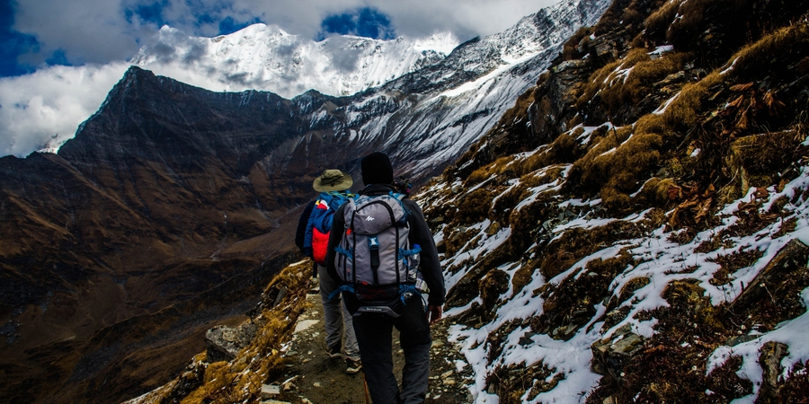
Day 3: Trek from Juda-ka-Talab to Kedarkantha Base (Lohasu)
- Trek Distance: 4 km
- Trek Duration: 2.5 hours
- Altitude Gain: From 9,100 ft to 11,250 ft
- Trail Highlights:
- Steeper trail under oak trees
- Walk past shepherd huts and alpine pastures
- Views of frozen trails and snowy landscapes
- Steeper trail under oak trees
- Mountain Views: Bandarpoonch, Swargarohini, Kala Nag, Ranglana
- Night Stay: Tents at base camp with picturesque mountain views
Day 4: Summit Kedarkantha Peak and Descend to Hargaon Camp
- Trek Distance: 6 km
- Trek Duration: 7 hours
- Altitude Gain: Summit at 12,500 ft
- Activities:
- Early morning summit push for sunrise view
- Learn snow trekking techniques from guides
- Visit the Shiva-Parvati temple and Ganesh shrine at summit
- Early morning summit push for sunrise view
- Summit Views: 360° views of Bandarpoonch, Swargarohini, Gangotri, Yamunotri
- Descent: Post-lunch trek down to Hargaon Camp
- Night Stay: Tents at Hargaon (twin sharing)
Day 5: Trek from Hargaon Camp to Sankri
- Trek Distance: 6 km
- Trek Duration: 4 hours
- Altitude Loss: Descend from 8,900 ft to 6,400 ft
- Trail Features:
- Downhill walk through pine forests
- Well-marked stone-paved path
- Soothing views of valleys and local hamlets
- Downhill walk through pine forests
- Arrival: Back in Sankri village
- Night Stay: Guest house or hotel in Sankri (if needed)
Day 6: Drive from Sankri to Dehradun
- Drive Distance: 220 km
- Drive Duration: 8–10 hours
- Departure: Early morning from Sankri
- Arrival: Dehradun Railway Station by 7–8 PM
- Travel Tip: Book return tickets accordingly
- Route: Scenic drive with one last look at the Himalayas
Best Time to Visit Kedarkantha Trek
Choosing the right time to trek is as important as knowing the route. Weather conditions can drastically impact trail accessibility and safety. Depending on the season, your experience of the Kedarkantha trek route map could change — from thick snow in winter to colorful forest trails in spring.
- December to February: Best for snow lovers and a true winter trek vibe
- March to April: Ideal for scenic views and melting snow paths
- May to June: Lesser snow, more greenery – good for relaxed trekkers
- October to November: Crystal clear skies, great visibility from the summit
Each season offers a unique take on the Kedarkantha trek route map, so choose according to the kind of experience you want.
Explore More Treks with MND Travels
At MND Travels, we offer more than just guidance through the Kedarkantha trek route map — we curate complete trekking experiences that cater to every type of adventurer. Whether you’re looking for a short weekend escape or a week-long Himalayan immersion, we’ve got you covered with our top-rated treks.
If you’re planning your next adventure, check out some of our most popular trekking packages on our official website:
- Nag Tibba Trek – 1 Night 2 Days: A perfect weekend trek ideal for beginners, this short journey offers stunning views of Bandarpoonch and surrounding peaks.
- Harki Dun Trek – 6 Nights 7 Days: For those looking for rich alpine culture and diverse landscapes, Harki Dun offers a deep dive into ancient trails and scenic meadows.
- Kedarkantha Trek Package from Dehradun – 5 Days 4 Nights: Our best-selling all-inclusive package with meals, transport, guides, and gear. It follows the exact Kedarkantha trek route map we’ve detailed above.
Kedarkantha Trek Difficulty Level
The Kedarkantha trek is known for being beginner-friendly, but don’t underestimate the importance of preparation. Even a relatively easy trail can become tricky without the right awareness. Knowing the Kedarkantha trek route map helps you prepare mentally and physically for the distance and elevation changes.
- Trek Grade: Easy to Moderate
- Trail Condition: Well-marked, but snowy patches can be slippery
- Fitness Level Required: Moderate – daily walking or jogging for 2 weeks prior helps
The combination of manageable elevation gain and supportive terrain makes the Kedarkantha trek route map suitable for all age groups, including solo travelers and first-timers.
Stay Options During Kedarkantha Trek
Comfortable accommodations can elevate your trek experience. While the route passes through remote locations, there are still good stay options at every major halt — from Sankri to the summit base. Knowing where you’ll rest each night also makes the Kedarkantha trek route map easier to follow and plan around.
- Sankri Village: Budget homestays and basic guest houses
- Juda Ka Talab & Base Camp: Tented accommodations under the stars
- Hargaon Campsite: Serene and forest-covered site for a peaceful night
Things to Carry for Kedarkantha Trek
Proper gear is your best companion on a Himalayan trek. Your checklist should align with both the terrain and season marked on your Kedarkantha trek route map. Weather can be unpredictable, especially during snow season, so be ready.
Essentials Include:
- Waterproof trekking boots
- Warm layers: thermals, fleece, down jacket
- Woolen cap, gloves, and neck gaiter
- Water bottle and energy snacks
- Headlamp, first-aid kit, personal meds
- Physical copy of Kedarkantha trek route map
Is the Kedarkantha Trek Easy or Difficult?
This question is one of the most searched by first-time trekkers — and it’s a valid concern. Compared to other summit treks in the Himalayas, Kedarkantha is relatively easy. However, specific stretches on the Kedarkantha trek route map can feel steep or challenging if you’re not used to walking on snow or uneven trails.
- Gradient: Gentle to moderate
- Snow Difficulty: Present in winter; guides required
- Fitness Required: Good stamina, not professional-level fitness
By reviewing the Kedarkantha trek route map, you can mentally prepare for each day’s effort and stay motivated.
How Long Does Kedarkantha Trek Take?
The trek is short but powerful. One of the best things about Kedarkantha is that it gives you the feel of a high-altitude Himalayan expedition in just 5 days. Each section of the Kedarkantha trek route map is compact, allowing you to explore nature without exhausting your energy or your time.
- Total Duration: 5 days (including travel)
- Trekking Days: 3 full days + 2 half days
- Distance Covered: Around 20–25 km round trip
This makes the Kedarkantha trek route map ideal for long weekends or quick getaways from cities like Delhi, Dehradun, or Chandigarh.
How to Reach Kedarkantha Trek Starting Point
Your journey begins long before the first step on the trail — it starts with reaching the base village. The Kedarkantha trek route map officially begins from Sankri, a small but lively village in Uttarkashi, Uttarakhand.
Reaching Sankri:
- By Air: Nearest airport is Jolly Grant (Dehradun)
- By Train: Dehradun is the nearest major railway station
- By Road: Buses or cabs available from Dehradun to Sankri (8–10 hrs)
Final Thoughts + Book with MND Travels
With its stunning summit, dreamy campsites, and beginner-friendly trail, Kedarkantha is truly the gateway to Himalayan trekking. But success on this journey depends on how well you prepare — and nothing is more important than having a reliable Kedarkantha trek route map.
Frequently Asked Questions
Q1: Is Kedarkantha trek risky?
A: No, it’s considered one of the safest winter treks in India. Snow may pose challenges, but with MND Travels’ expert guides and proper gear, it’s absolutely safe.
Q2: Is Kedarnath the same as Kedarkantha?
A: No. Kedarnath is a religious pilgrimage, while Kedarkantha is a summit trek. Both are beautiful, but very different in nature.
Q3: Can I go without a guide?
A: It’s possible, but not advisable — especially in winter when trails are snow-covered. A guided trek ensures safety and a richer experience.